Berkovska Planina
(Surovichnitsa to Kom)
Berkovska Planina forms the final section of the Western Balkan before Mount Kom. The route stays mostly above the treeline over rounded summits with gentle elevation while following a wide cart road.
Beyond Surovichnitsa the cart road continues through forest for roughly 6 km. The tread sometimes grows grassy but never loses definition, and at Yavorova Chuka (pillar 313) it opens onto a broad ridge meadow with a convenient bivouac spot below. A left-hand fork drops toward Diva Slatina, and support vehicles can reach that turnoff.
Two kilometers farther you reach Mount Dobro Utro, where a half-ruined border post makes another pleasant bivouac. The summit opens wide views north to Kopren, east toward the Ogosta reservoir and Montana, and south to the Vratsa range and Kom. A contouring track beneath the peak hosts two springs—one on the northeast side and another on the southeast.
The broad cart road—practically a “highway”—keeps you on the ridge all the way to Kom. Just past Mount Roga the path drops into a beautiful beech forest for the last time before the finish, and shortly before the woods end the Prelevski shelter and Grozdin spring lie about 50 m to the left. From there an unmarked track descends toward the village of Dalgi Del.
Soon after leaving the woods a fork appears: keep right to remain on the ridge and border line, because the left branch drifts gently downhill away from the main route.
After roughly 3 km you reach Mount Srebarna at pillar 304, the last summit along the boundary. Kom now dominates the skyline. The road swings east, gradually leaving the border, and after about 1 km of descent you arrive at a junction where the left branch leads to the half-ruined Anibal outpost and Konyarski spring while the traverse continues straight.
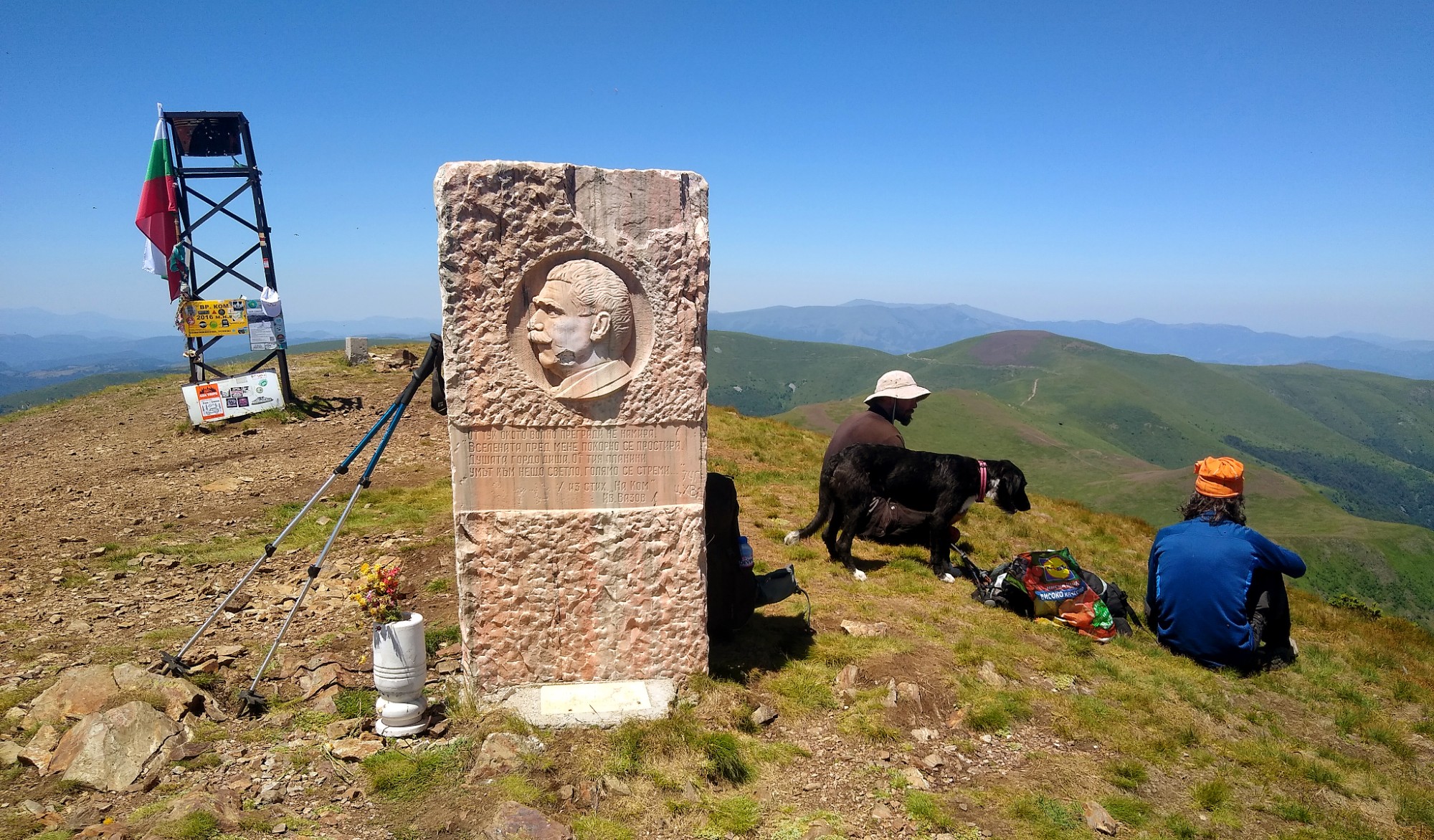
Another 5 km beyond that split begins the final climb to Mount Kom (2,016 m). The steep ascent gains approximately 250 m over the last 1.5 km before you reach the summit panorama.
Kom marks the official end of the Vrashka Chuka – Kom traverse. From the summit you can descend to Kom hut and onward to Berkovitsa, or continue east toward Petrohan pass and the remainder of the Balkan along the E3 trail to Cape Emine. E3 and E4 part on Kom, with E4 expected to head south toward Sofia and Dragalevtsi once that section is officially laid out.
Elevation profile
- Distance
- 24.5 km
- Ascent
- 1823 m
- Descent
- 1231 m
Save this GPX file on your device before setting off—your navigation app can replay the trail line through Bulgaria’s Western Balkan and keep you on the border ridge.