Chiprovska Planina
(Sv. Nikola to Surovichnitsa)
Chiprovska Planina starts at Sveti Nikola pass, crosses the highest stretch of the Western Balkan, and finishes at Surovichnitsa beyond Mount Kopren. This stage stays mostly above the treeline in alpine terrain.
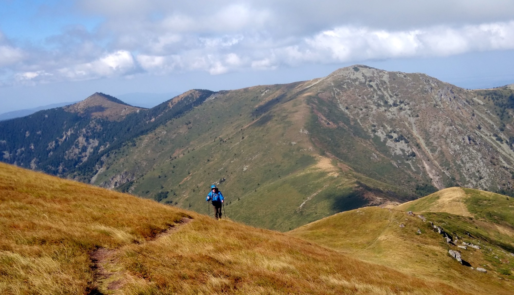
From Sveti Nikola pass the trail follows the Bulgarian cart road through forest. After about 700 m you reach a wide ridge meadow that climbs gently for roughly 1 km to Shilya Chuka. Beyond that begins a challenging 3 km section of dense juniper. A narrow corridor has been carved through, and red-white signal ribbons—and occasionally paint on trees and rocks—mark the way because there are few tall trees suitable for traditional blazes. Around 1 km later the path dips below the ridge into forest, re-emerges near pillar 339, then continues through the juniper before entering a pine section punctuated by high rock steps. With careful attention the reward is sweeping views toward Serbia and the Babin Zub resort.
After the woods the trail climbs a steep open ridge to Replyanska Tsarkva (mapped as Ostra Chuka). Springtime meadows here bloom with white pasque flowers, and from the summit the route drops toward a saddle where a spur leads down to Gorski Rai hut.
Gorski Rai sits about 3 km below the crest with roughly 500 m of descent. The hut operates mainly Friday through Sunday and by request, and its welcoming hosts serve truly delicious food. The trail to the hut crosses the scenic Chuprenska Reserve, which floods with raspberries in midsummer, and about 800 m/140 m below the ridge a strong spring pours beside the path. Gorski Rai is roughly the midpoint of the Vrashka Chuka – Kom traverse and makes an excellent rest stop.
From the saddle between Replyanska Tsarkva (Ostra Chuka) and the other summit the route climbs to Mount Oba (2,033 m), the first peak over 2,000 m. This point marks the informal start of the second half of the traverse, during which the trails become more trodden. The segment from Replyanska Tsarkva to Trite Chuki is not yet marked, but the tread is clear enough to follow.
After Oba the path descends to the col at pillar 336. A left spur heads toward Gorni Lom via the Kozya Grbina ridge; about 700 m off the ridge you find a spring, and 500 m farther sturdy shelters appear. This is the classic approach from Gorni Lom to Midzhur, with the Midzhur hut another 5 km away and about 1,000 m below the crest.
From the col the trail starts climbing to Mount Midzhur (2,169 m), the highest summit of Western Stara Planina and all of Serbia.
After Midzhur the ridge runs relatively level over Orlov Kamik to the col near Ushite. From here you can stay on the crest toward Martinova Chuka or drop down the trail to Martinitsa shelter. The downhill option reaches the bench under Martinova Chuka after 2 km and 250 m of descent—a popular bivouac site—and another 1 km leads to the shelter itself.
Martinitsa comprises three small buildings (two dorm rooms and a kitchen) maintained by mountaineers from the village of Martinovo. A spring and potato fields sit nearby if you are short on supplies.
If you prefer to stay close to the crest, the bench bivouac under Martinova Chuka is reachable by support vehicles. Roughly 600 m farther along the crest-side trail lies the Gurdavets spring, the source of the Ogosta river.
Beyond Martinova Chuka the ridge passes over Golema Chuka. On the saddle before Vrazha Glava a track drops left toward Chiprovtsi, and about 1 km away (50 m below) there is a small spring. Continuing along the ridge brings you past Vrazha Glava to Pavlov Krast, where another spur leads down to Chiprovtsi.
Two kilometers further you arrive at the iconic Trite Chuki—three jagged towers. The trail skirts the first tower on the left, passing the Voinishkoto spring 20 m below, then climbs straight over the second and third towers without a safe bypass. From Trite Chuki to Mount Kopren the ridge is now continuously marked via the stretch over Mount Tri Kladentsa.
Mount Kopren (1,965 m) is another emblem of the range—gentle on the Serbian side yet steep toward Bulgaria, with panoramas covering the Ogosta reservoir and the town of Montana. A steep descent leads to a half-ruined border post where the traverse veers right onto the traversing path below Kopren.
The marked trail that drops straight down reaches Kopren hut (5 km and 1,000 m below), but it is not the recommended line if you want to stay on the main traverse—even though the waterfalls in that area are beautiful. From the ruined border post the traverse heads toward pillar 317, the final unmarked stretch before Katsa Kamik. Low juniper makes travel manageable, but about 200 m southeast the path plunges down a steep slope. From the base a narrow corridor cut through the juniper climbs gently southwest back to the crest. Stick within this corridor and rely on the GPS track.
Back on the ridge the trail descends toward Katsa Kamik, which you bypass through the Serbian-side forest because the Bulgarian slope is too steep. Once past Katsa Kamik the markings remain continuous all the way to Kom.
South of Katsa Kamik a broad meadow opens that once hosted Torlak gatherings; a stage and flagpoles still stand there. After the meadow the route re-enters Bulgarian forest along a well-defined cart road. After about 2 km the path skirts Mount Surovichnitsa, marking the end of Chiprovska Planina and the beginning of Berkovska.
Elevation profile
- Distance
- 36.9 km
- Ascent
- 2620 m
- Descent
- 2577 m
Save this GPX file on your device before setting off—your navigation app can replay the trail line through Bulgaria’s Western Balkan and keep you on the border ridge.